Landscape Architecture, Semester 5
Project Description
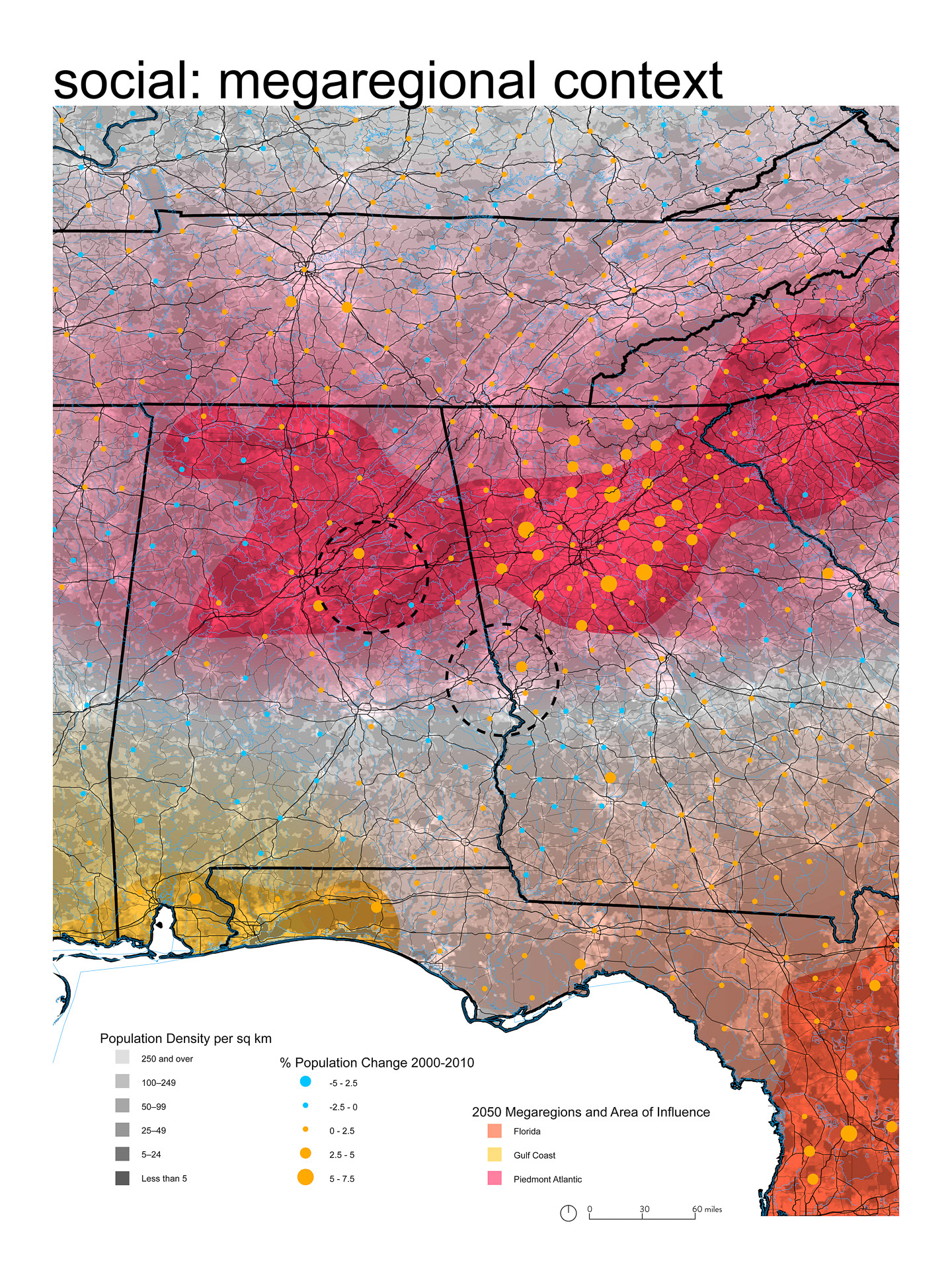
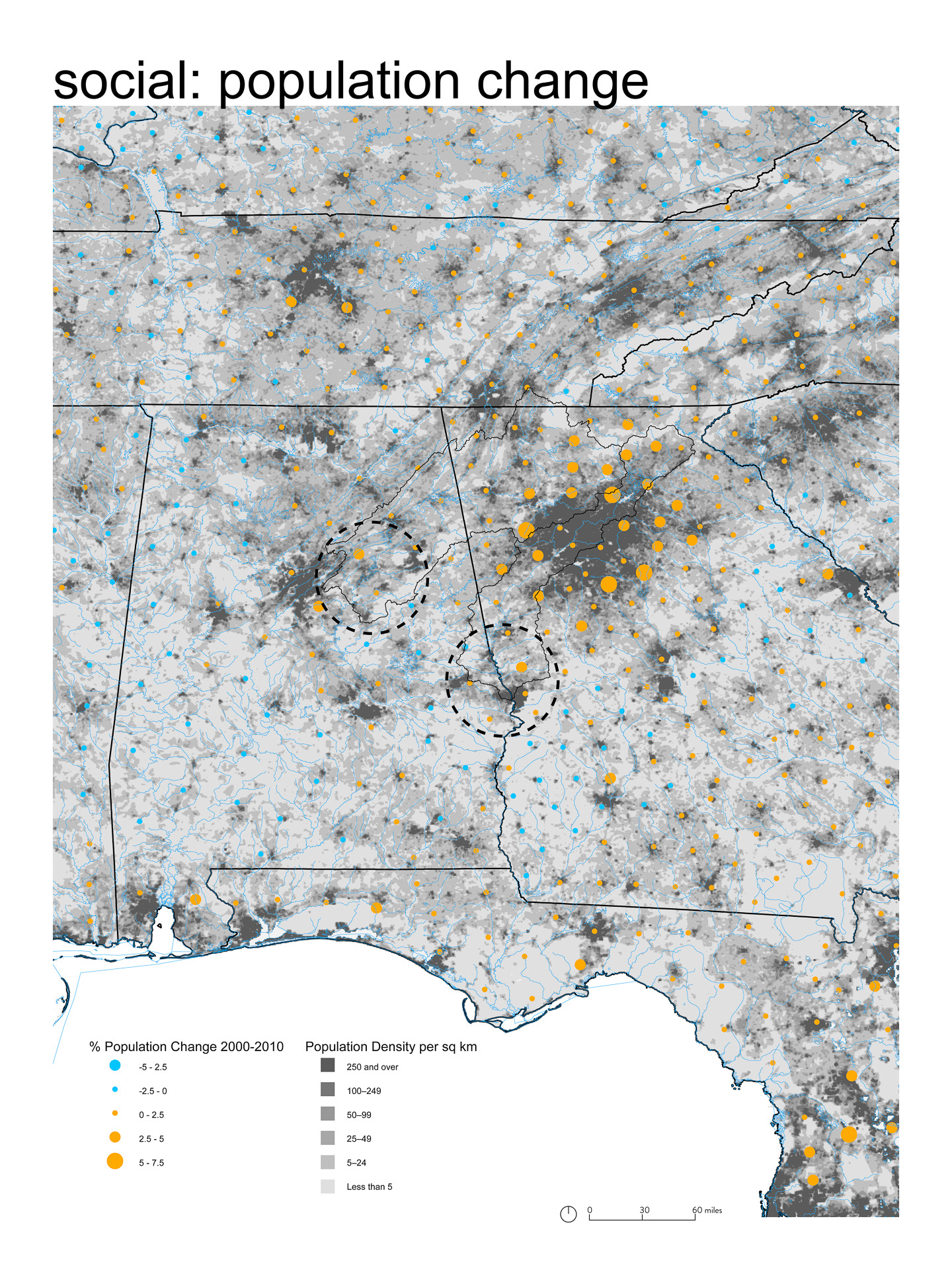
I began this semster by identifying and interpreting the social landscapes of the waters of Alabama. In that process I discovered two things. First, the site I chose in Columbus, Georgia exists of the edge of three megaregions: Piedmont Atlantic, Gulf Coast and Florida (megaregions show large scale time patterns of conurbation and transportation networks, America 2050).
Second, the pertinent threat of flood and drought to human and non-human habitat. The appalachicola Chattahoochee Flint River Basin is a hotly contested political battleground between upstream and downstream interests. Increasing pressures due to urbanization and hydrological modification, in combination with increasing variability due to climate change will only worsen these tensions.
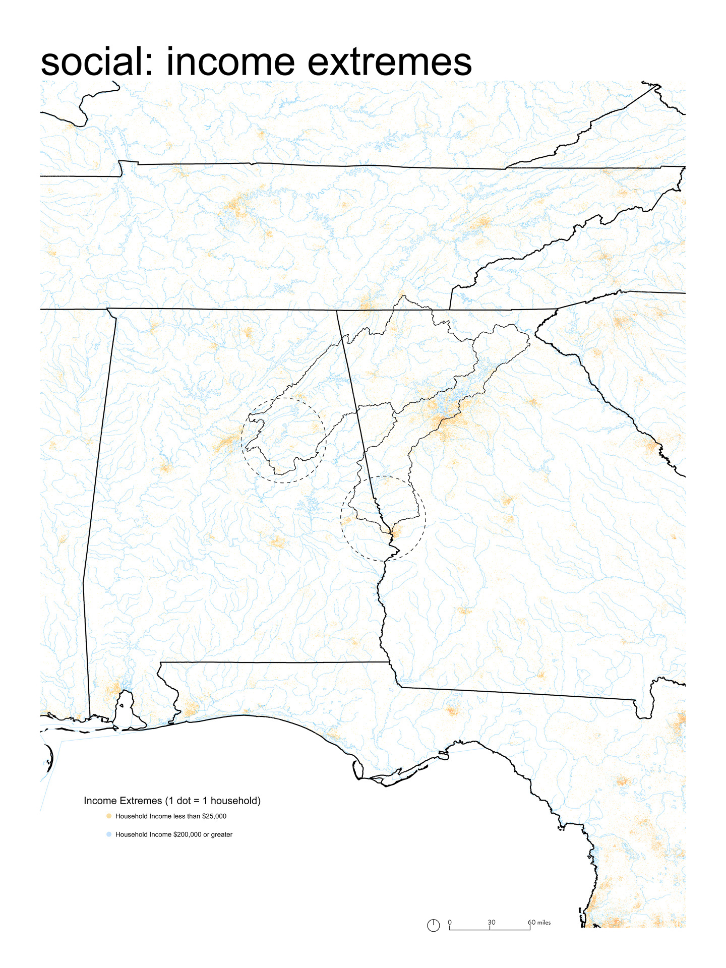
In Downtown Columbus, the threat of flood is a dominant concern that leaves the most vulnerable, low income population at risk. The cultural landscape is at risk because these neighborhoods are often historically black. Flood also threatens the future of the city as flood deters downtown commercial expansion southward.
Analyzing the Cultural Landscape
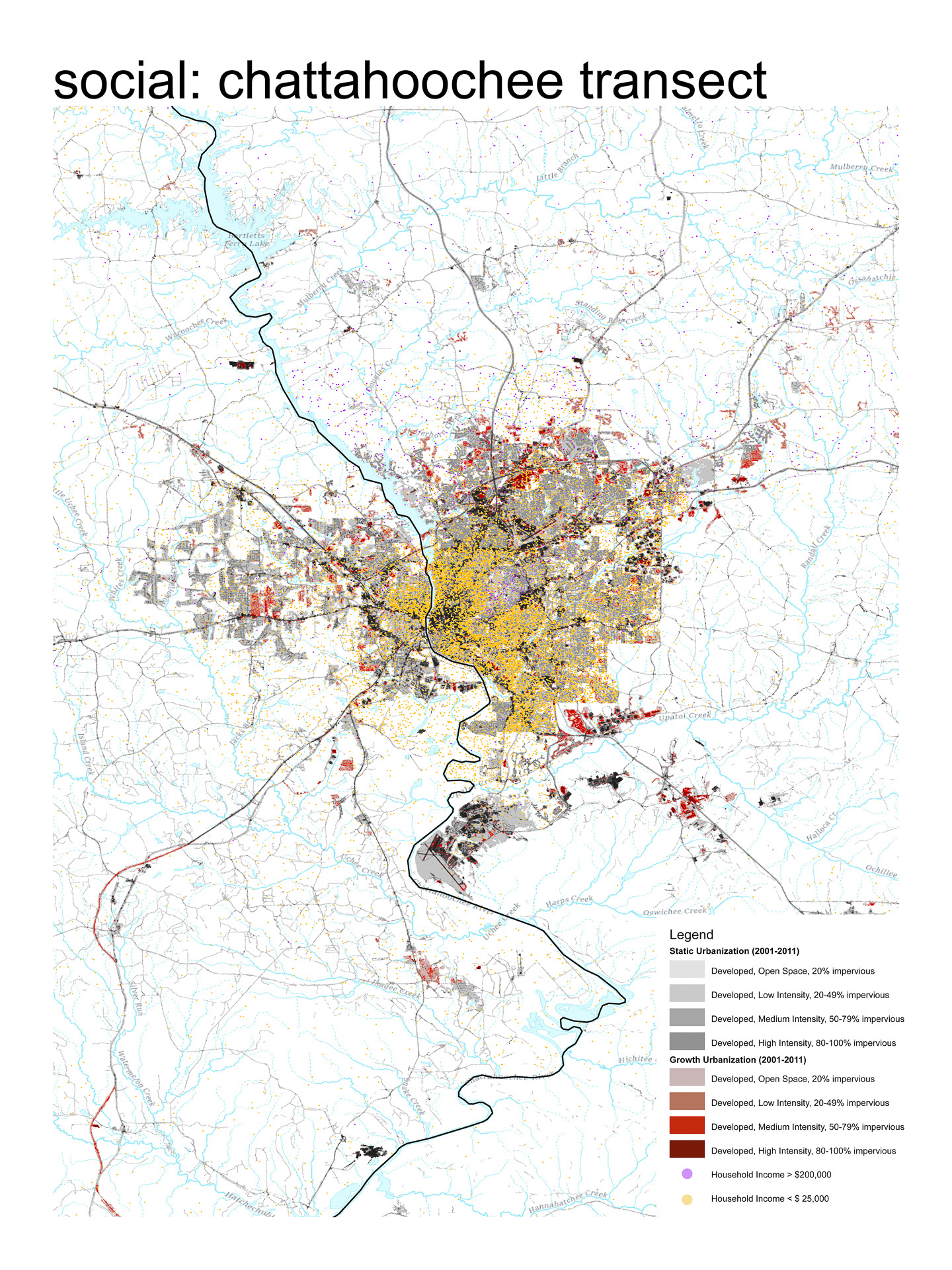
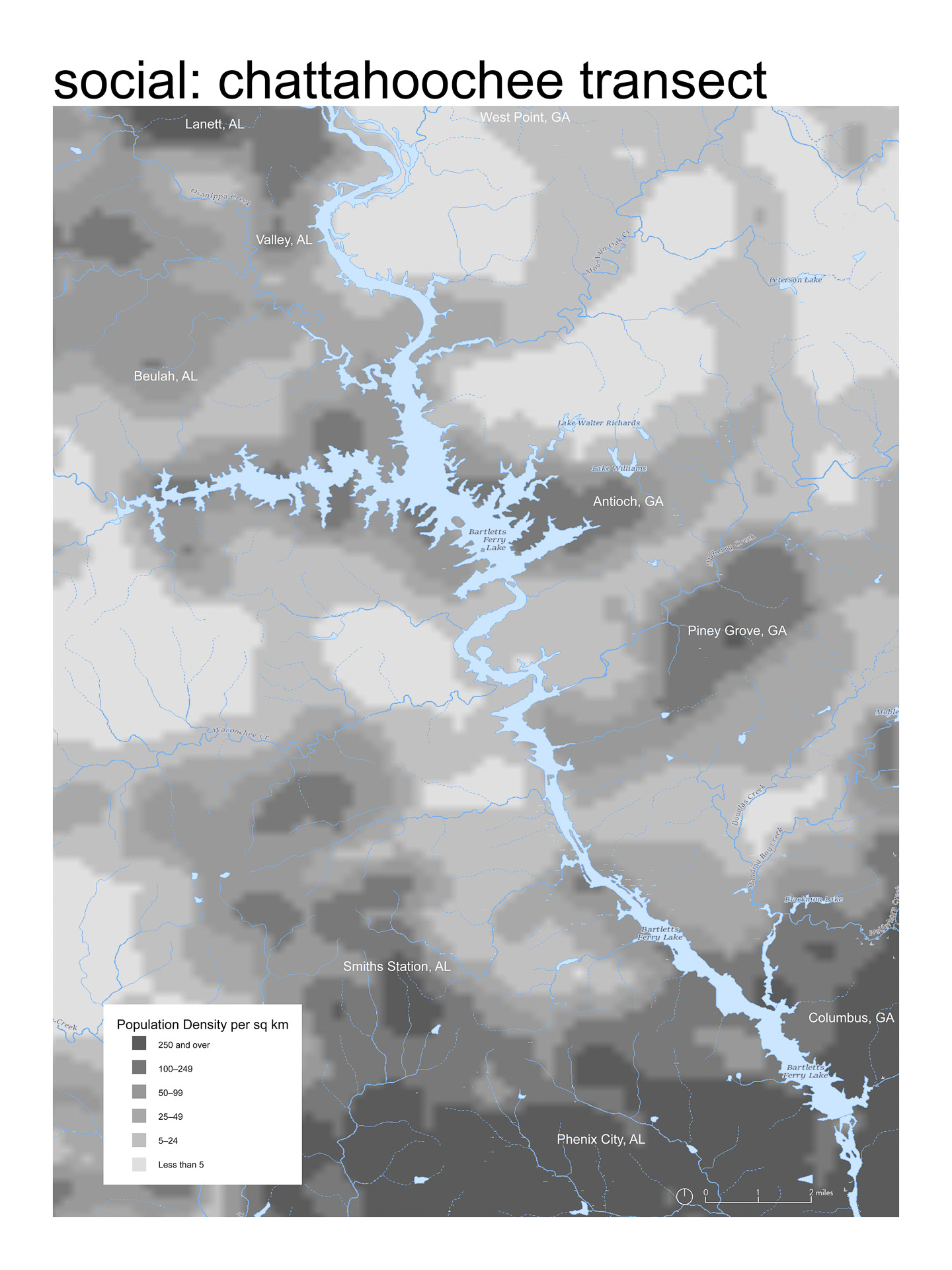
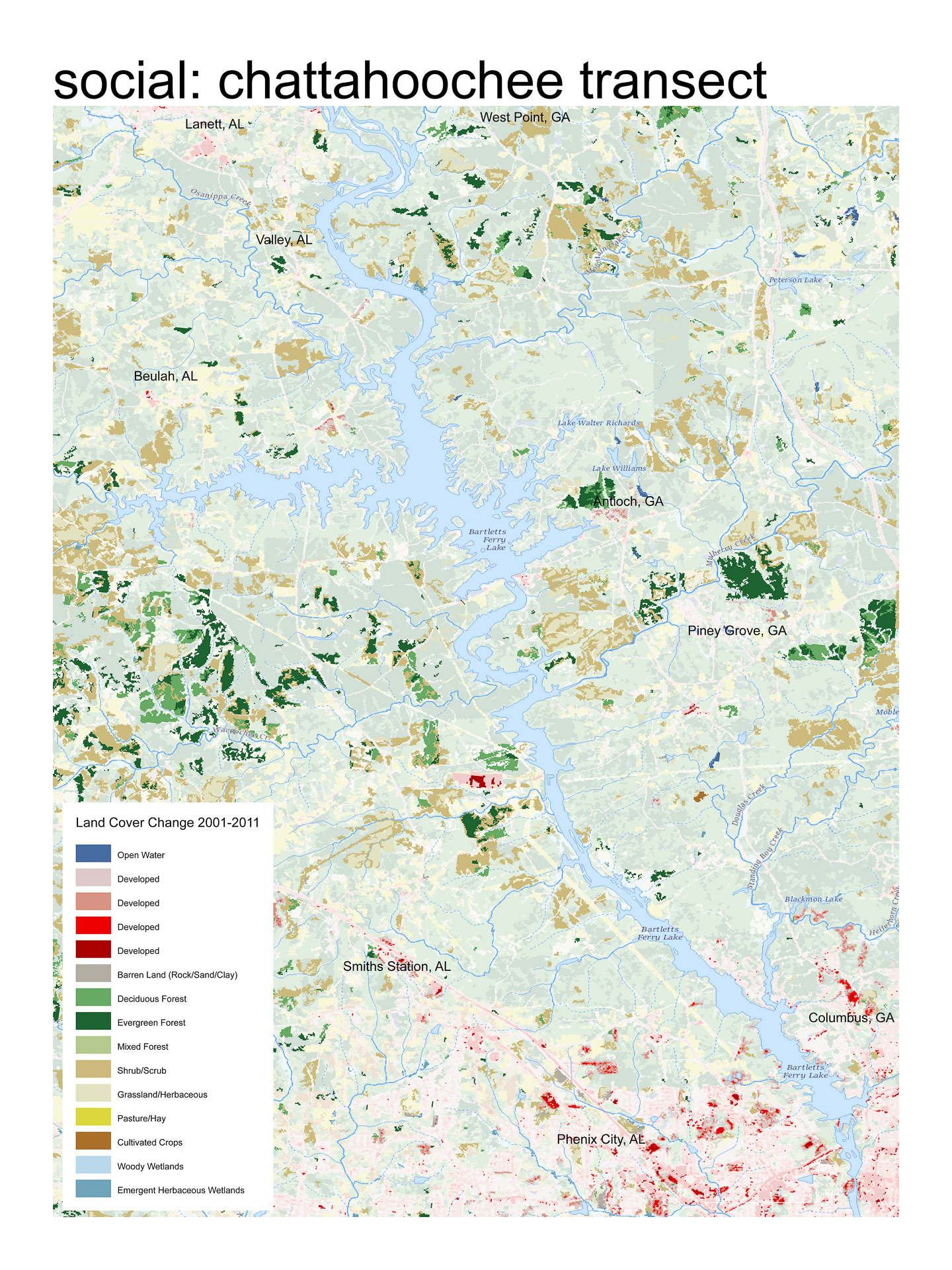
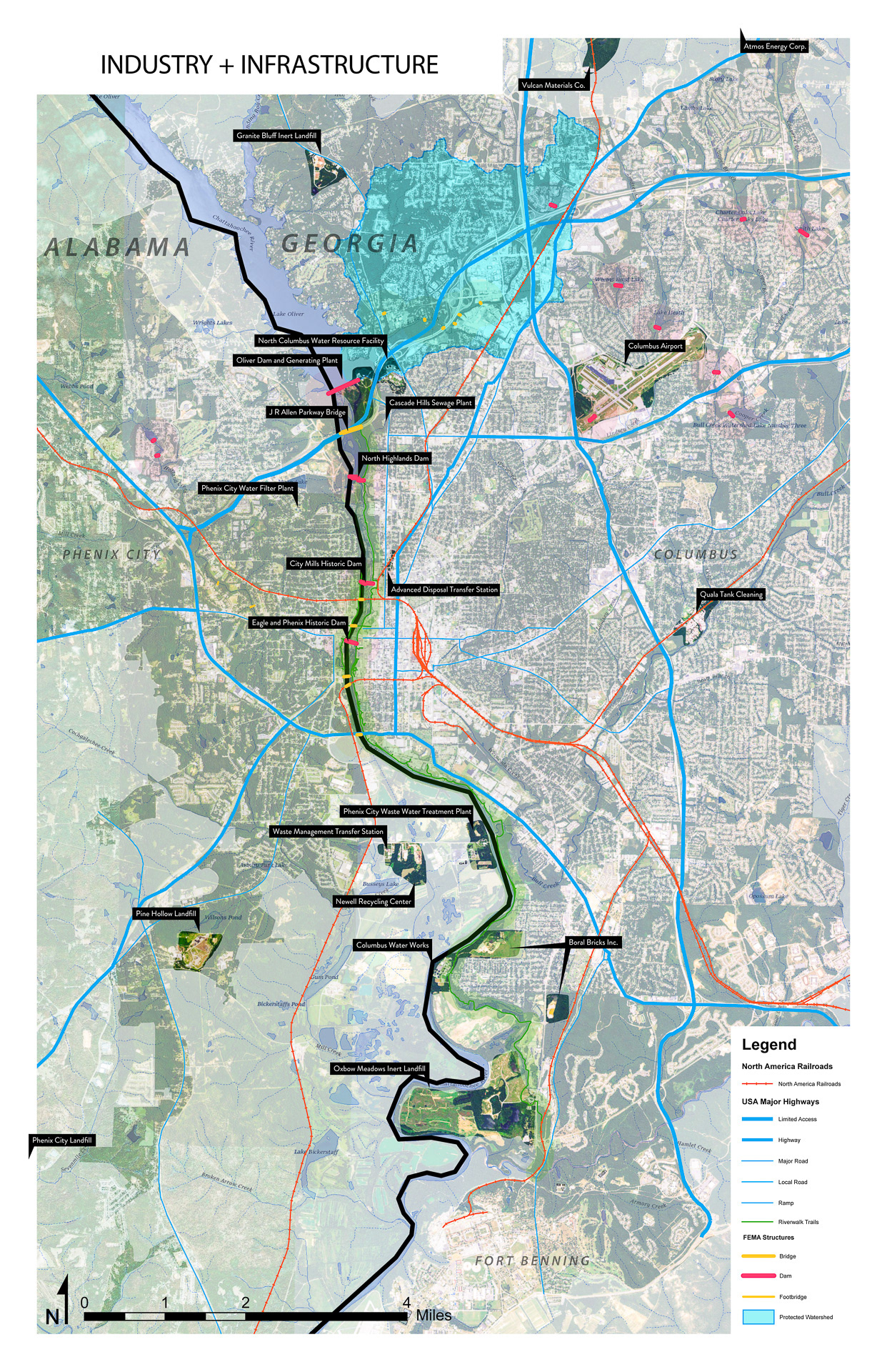
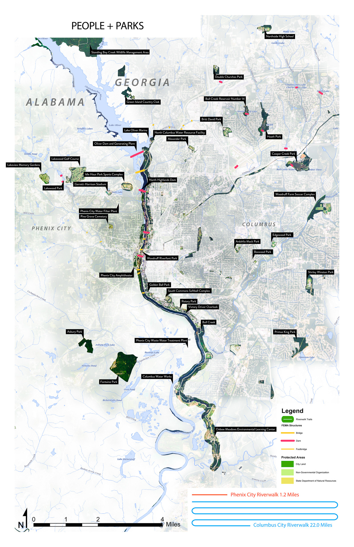
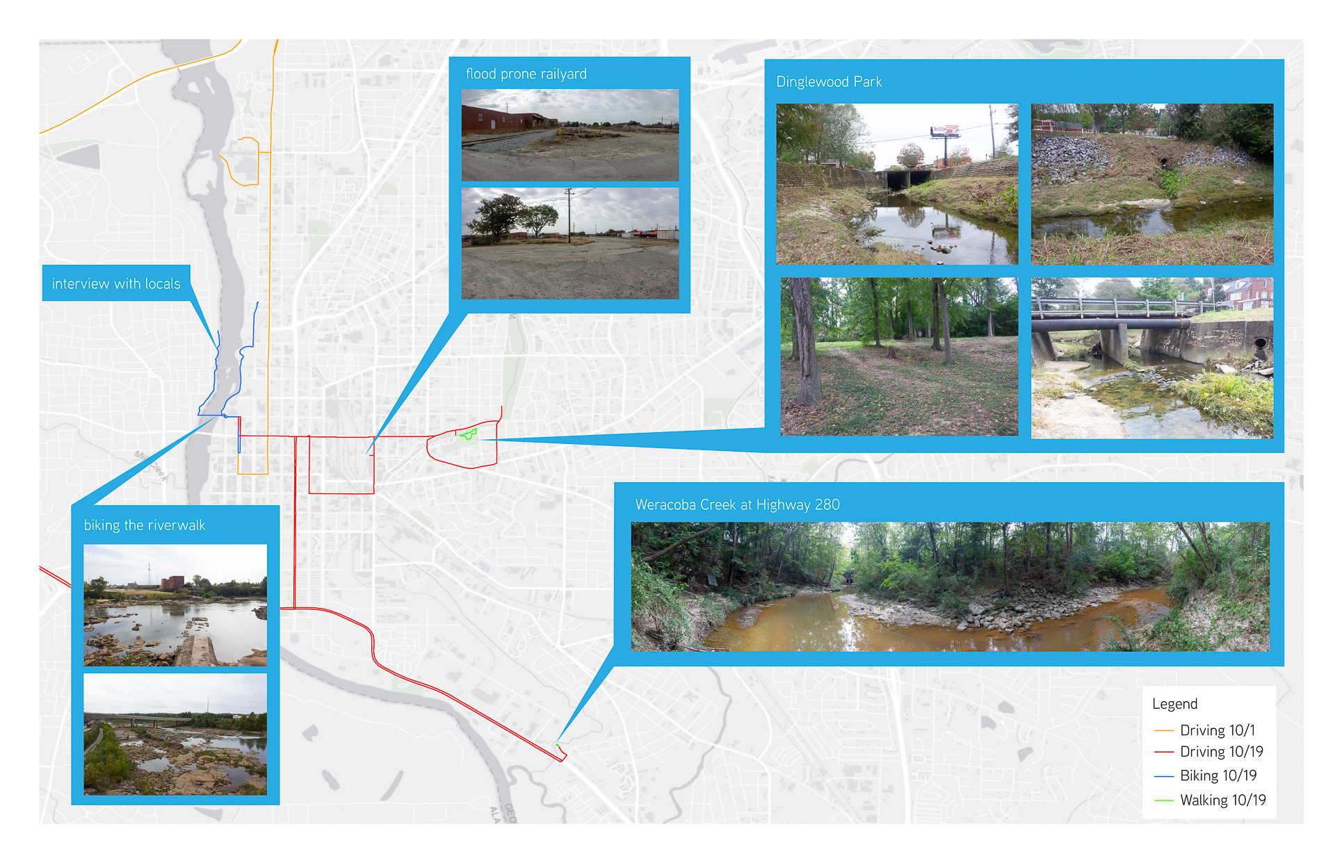
Downtown Columbus Regional Context Maps
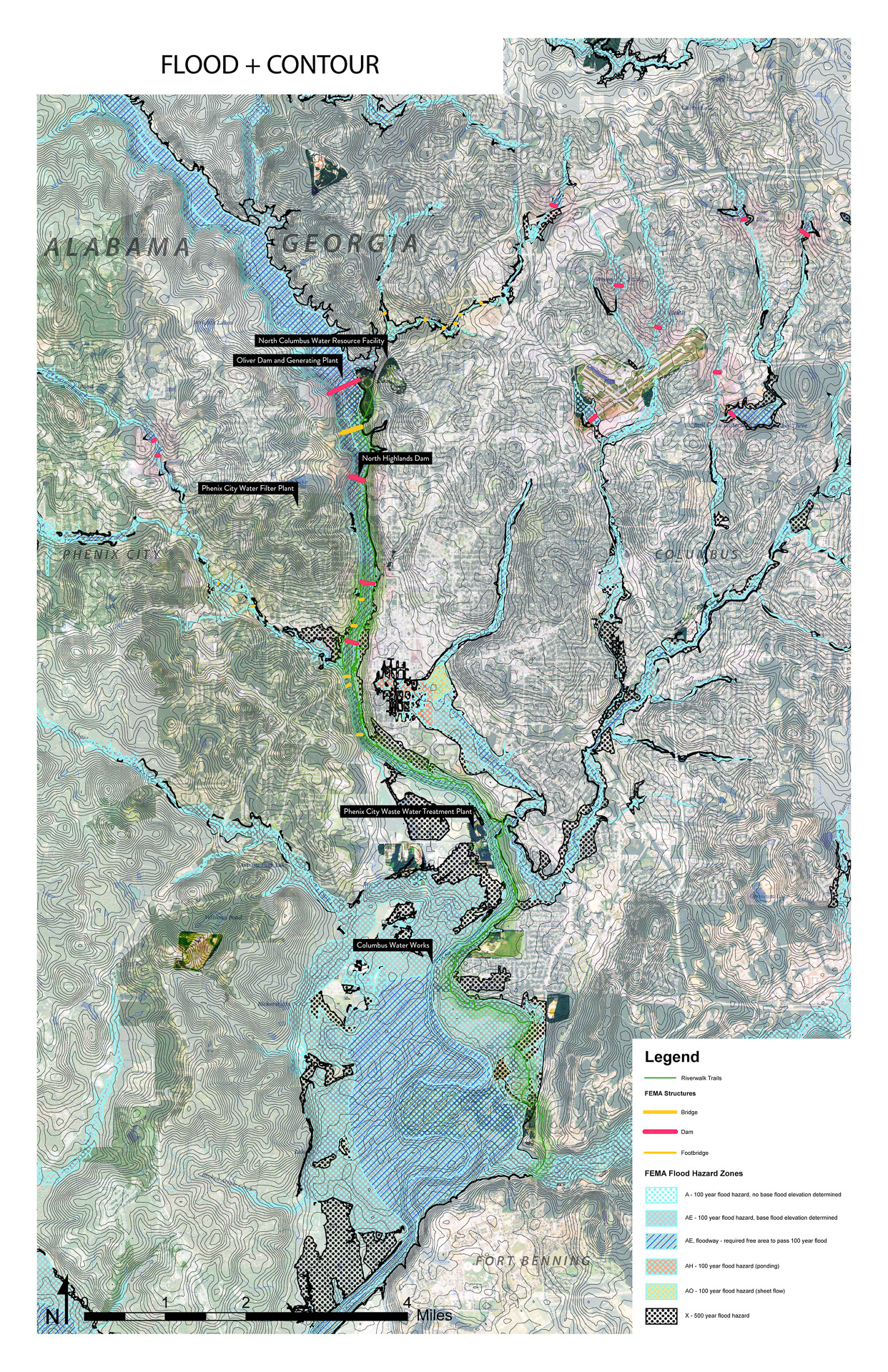
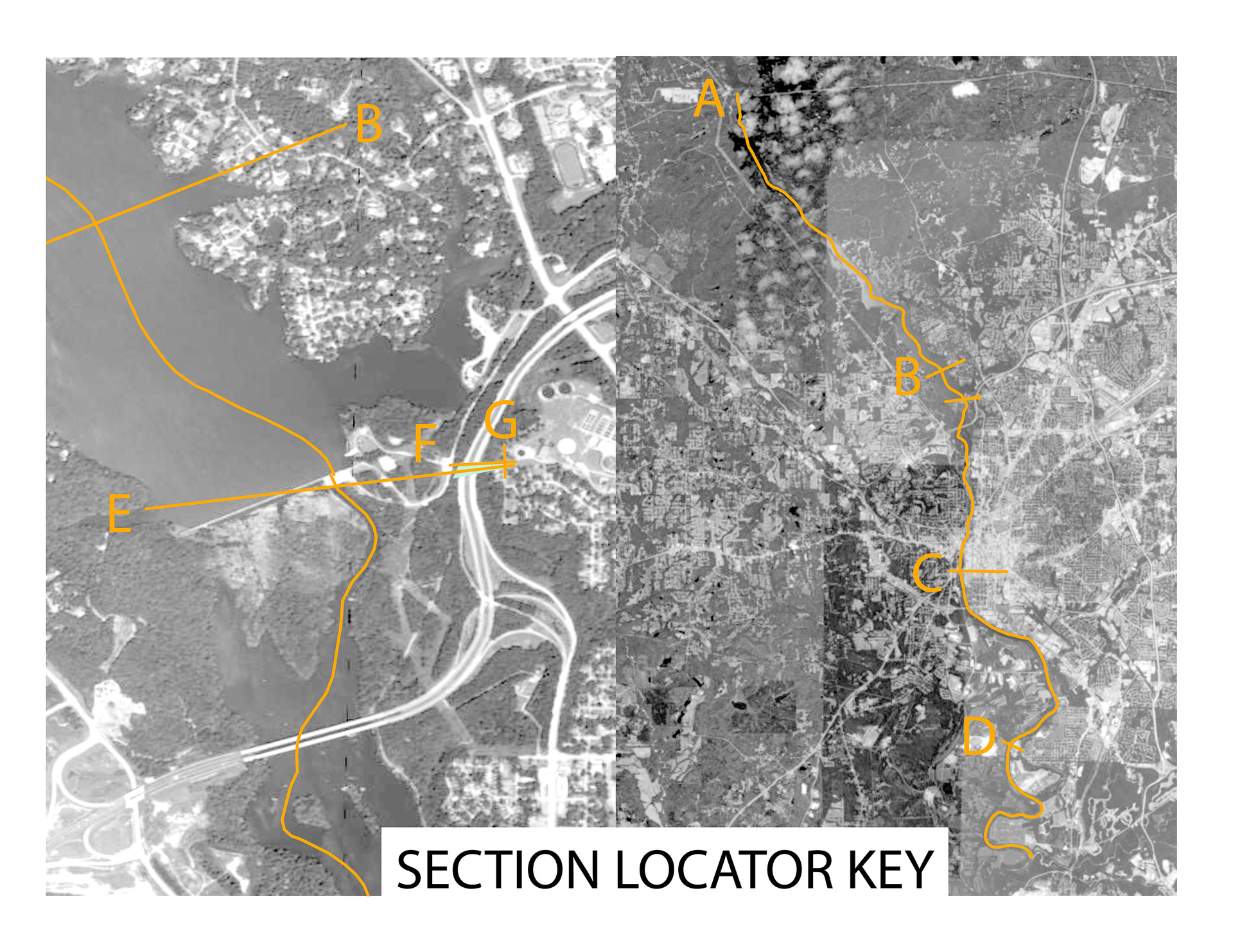
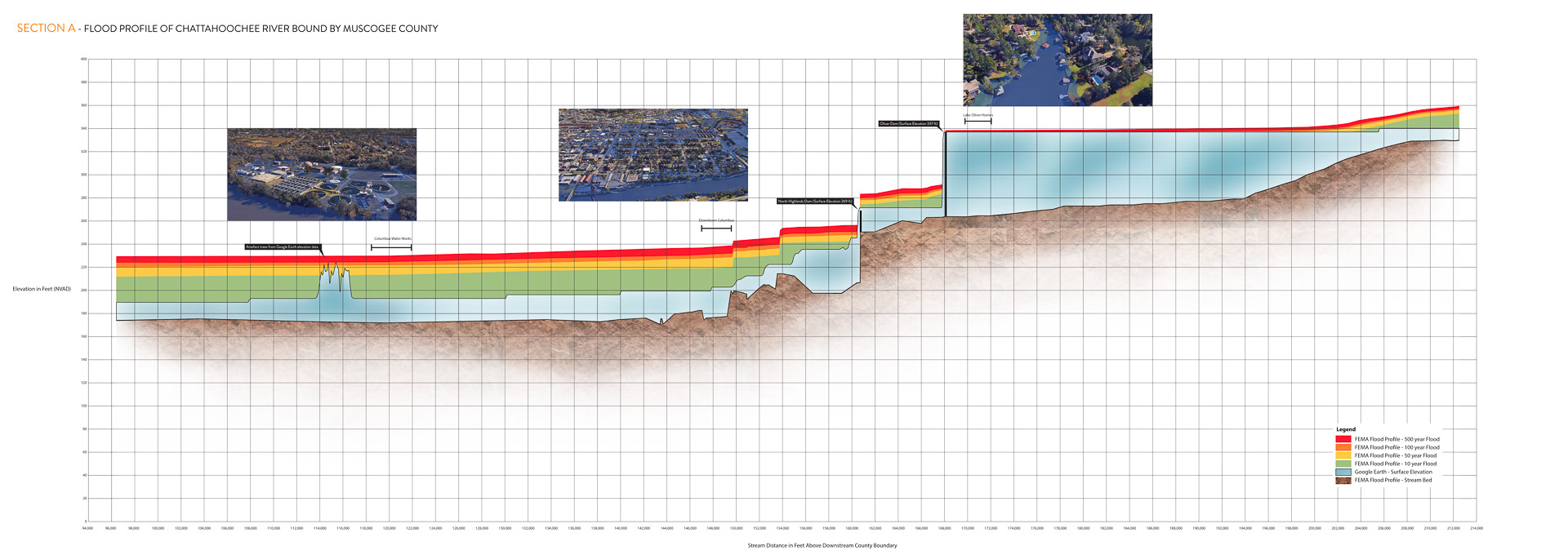
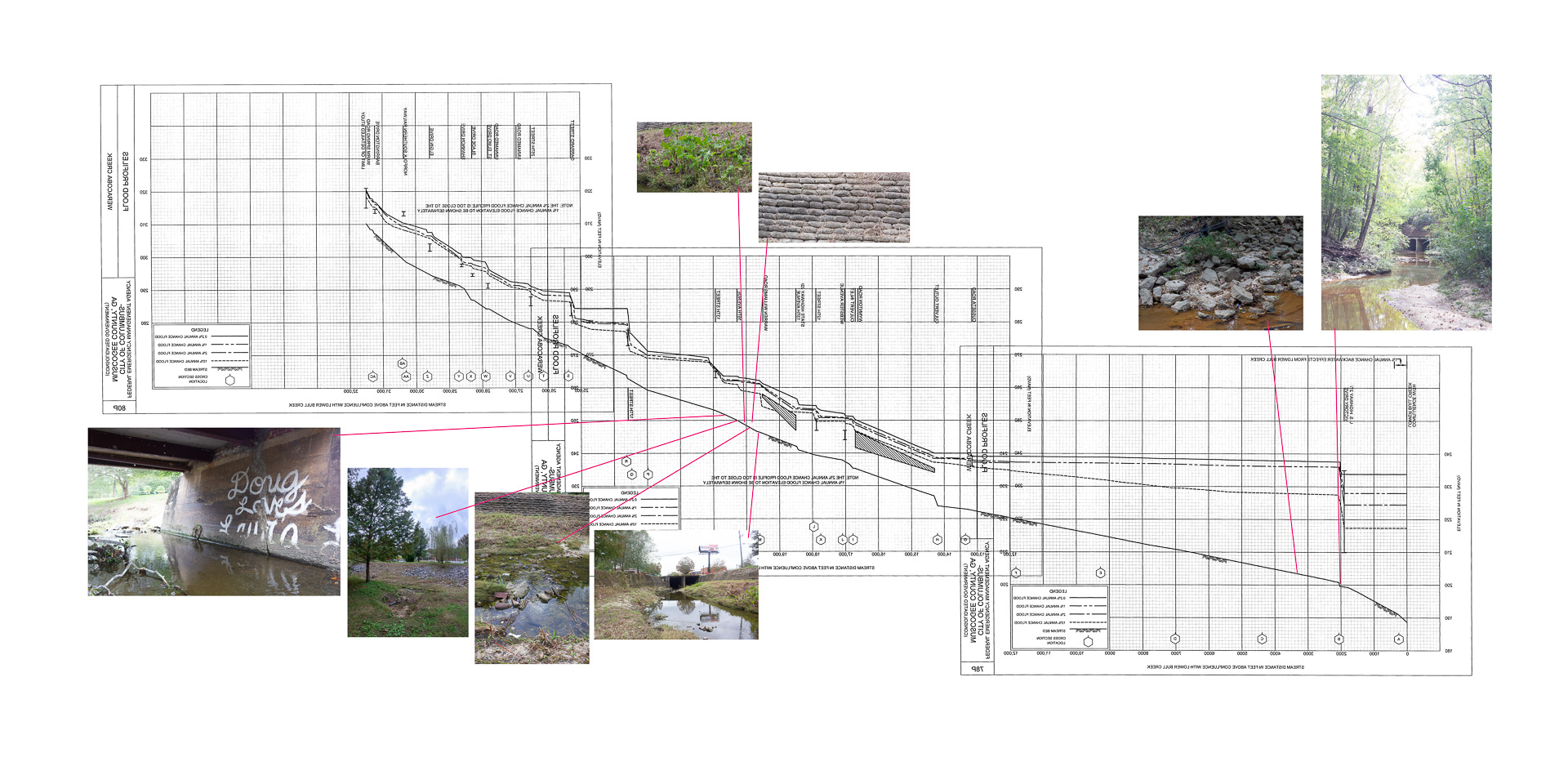
Drawing the Flood
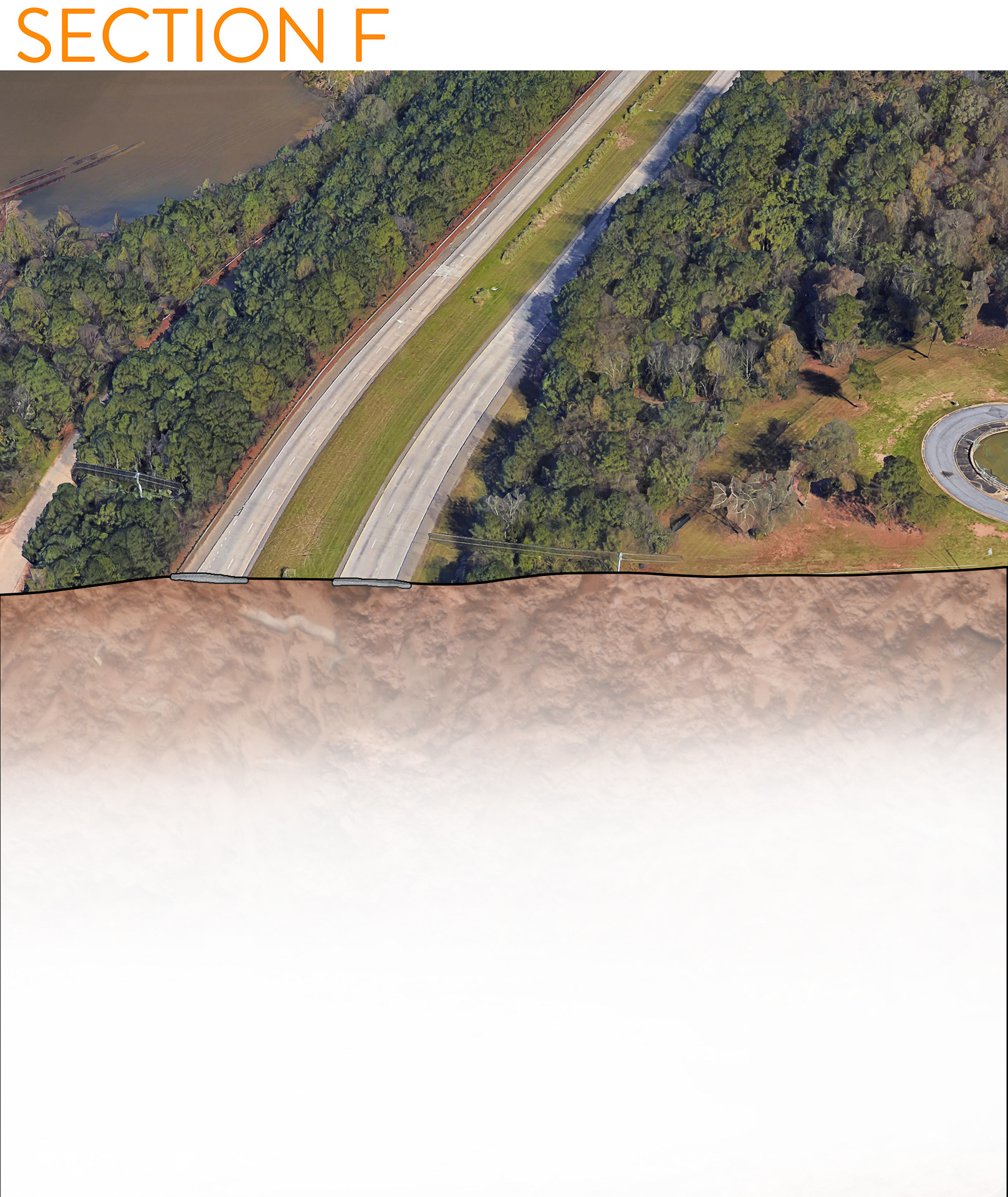
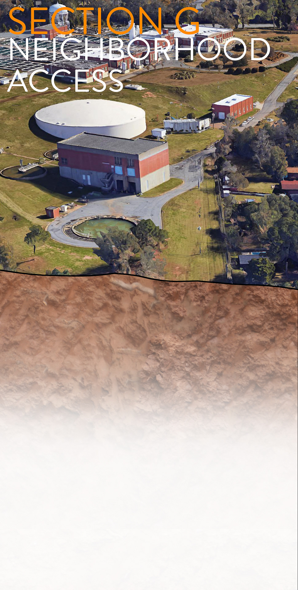
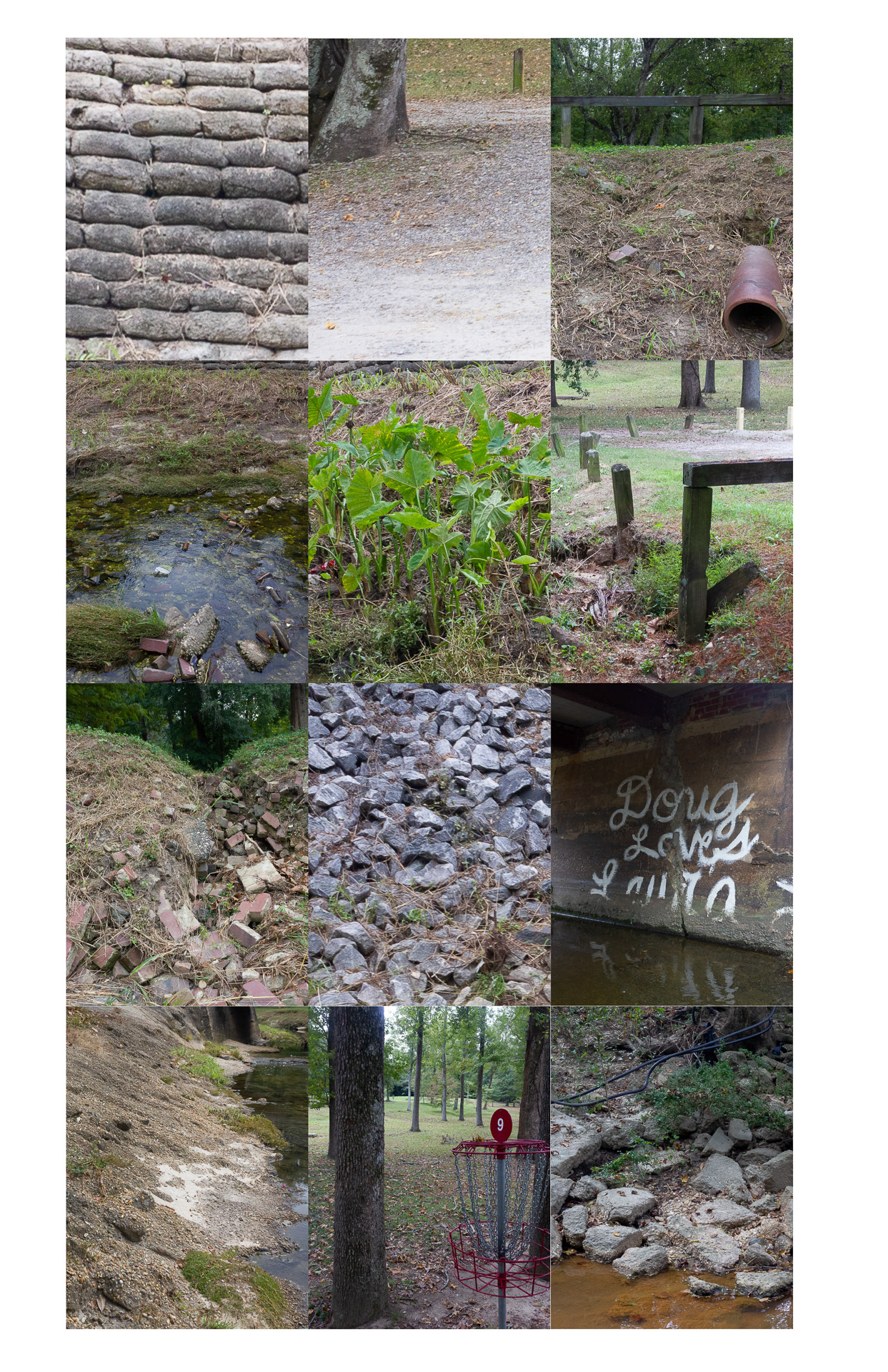
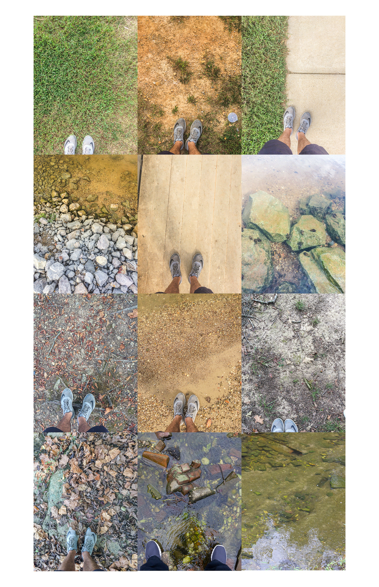
Site Recording
The Proposal
Therefore, the project I am proposing is for the city of Columbus to invest into new blue and green networks looping the existing Riverwalk and Fall Line Trace Trail through Weracoba Creek. The Weracoba is the cause of the downtown flood threat. A series of flood mitigation strategies can be linked to create new public space for underserved areas while also being ecologically productive to wet habitats - blue and green networks.
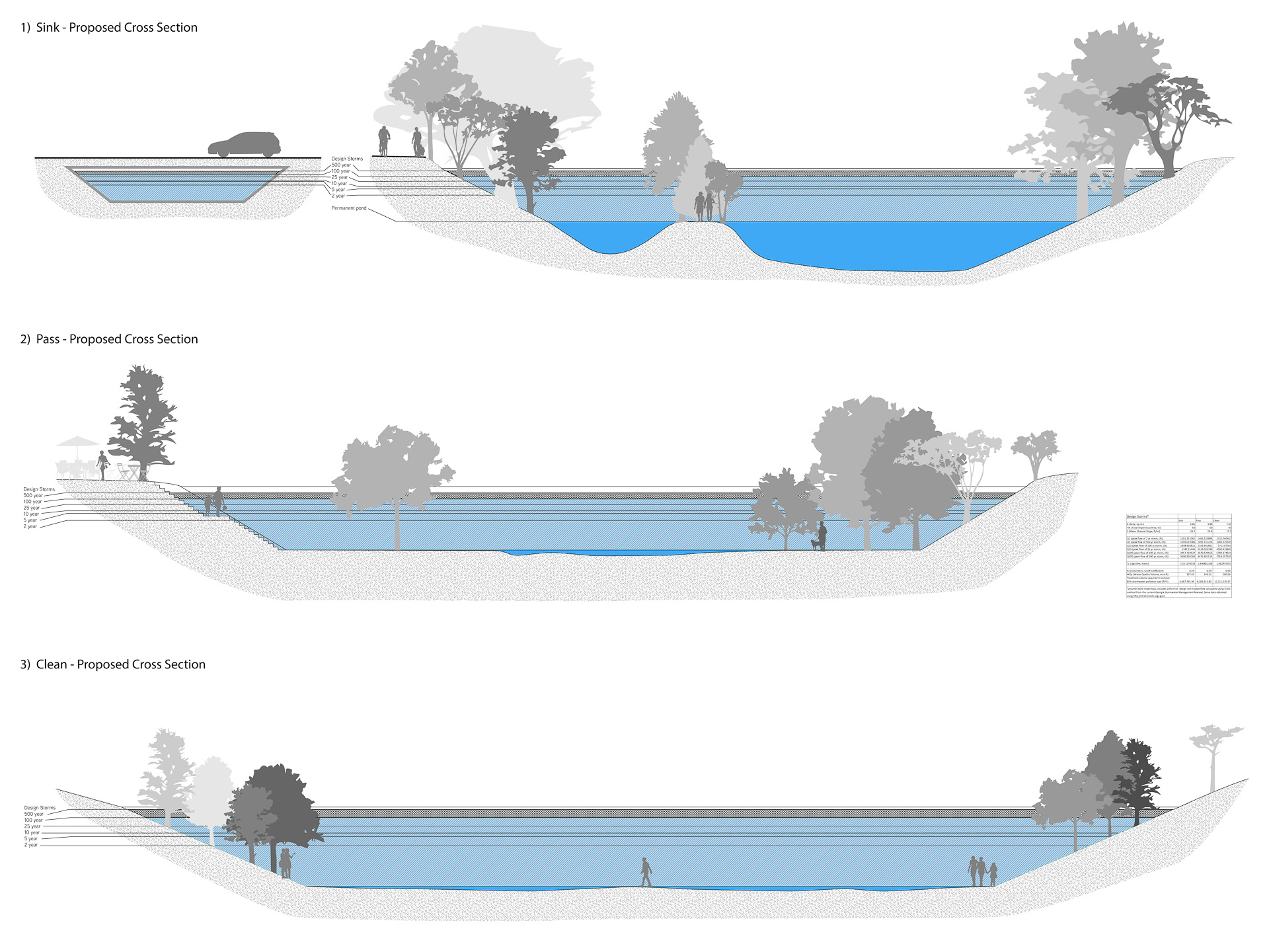
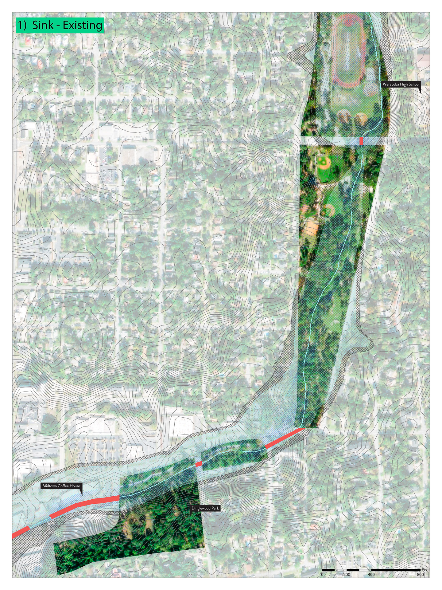
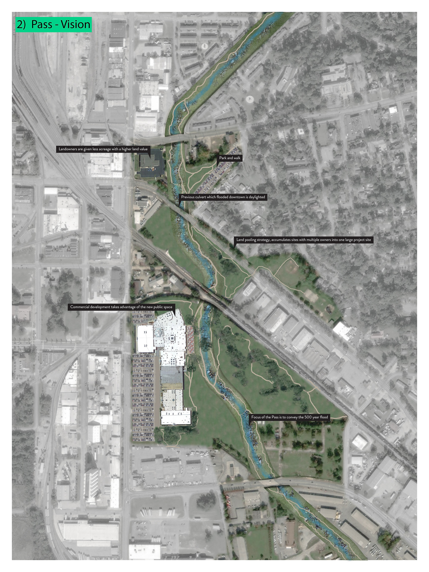
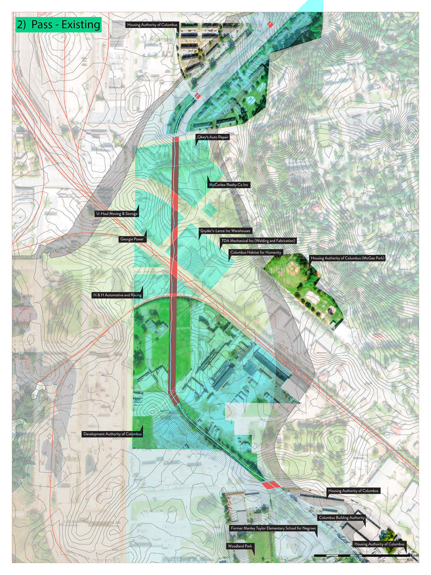
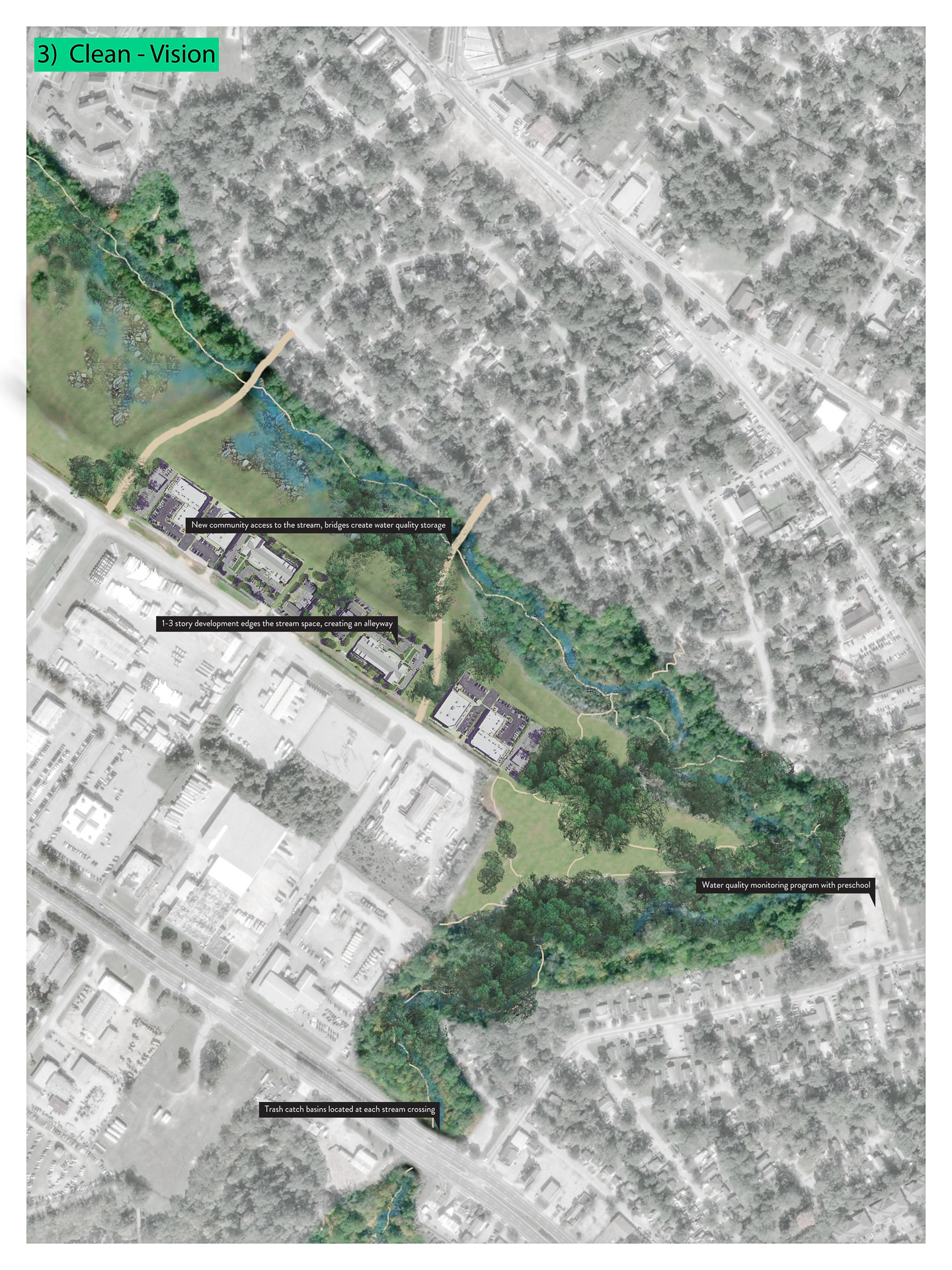
This loop is defined by three sites, each with distinct program and performative goals: 1) Sink, 2) Pass, 3) Clean. These performances seek to improve upstream-downstream dynamics, and are a case study of the larger Appalachicola Chattahoochee Flint River Basin dynamics. This strategy can be modified to meet other hydrological problems in the basin such as the flooding problems in Lannette.
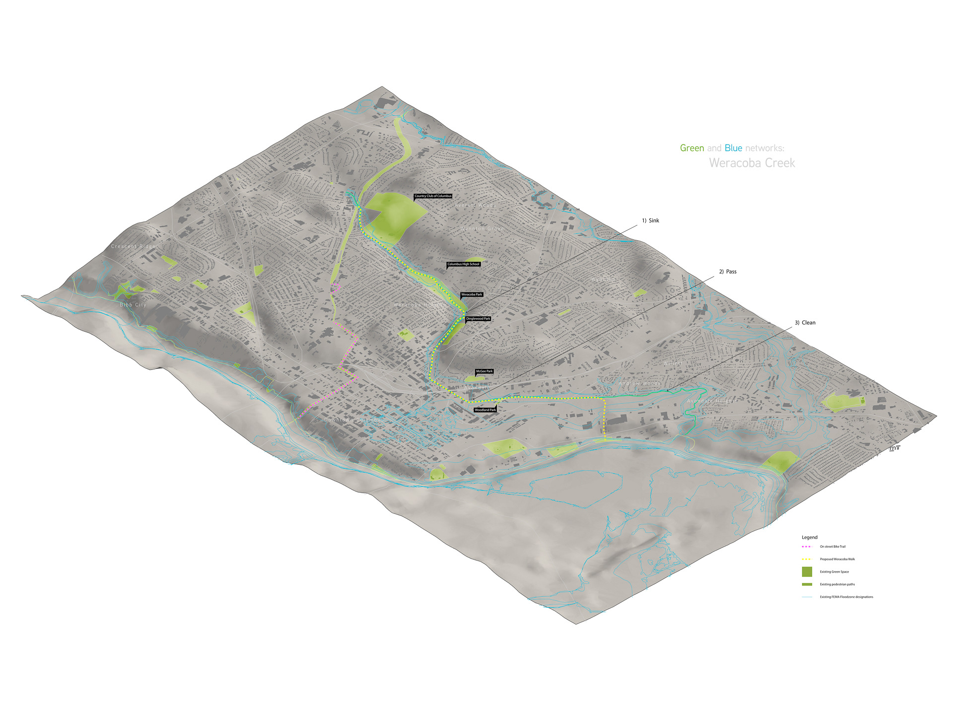
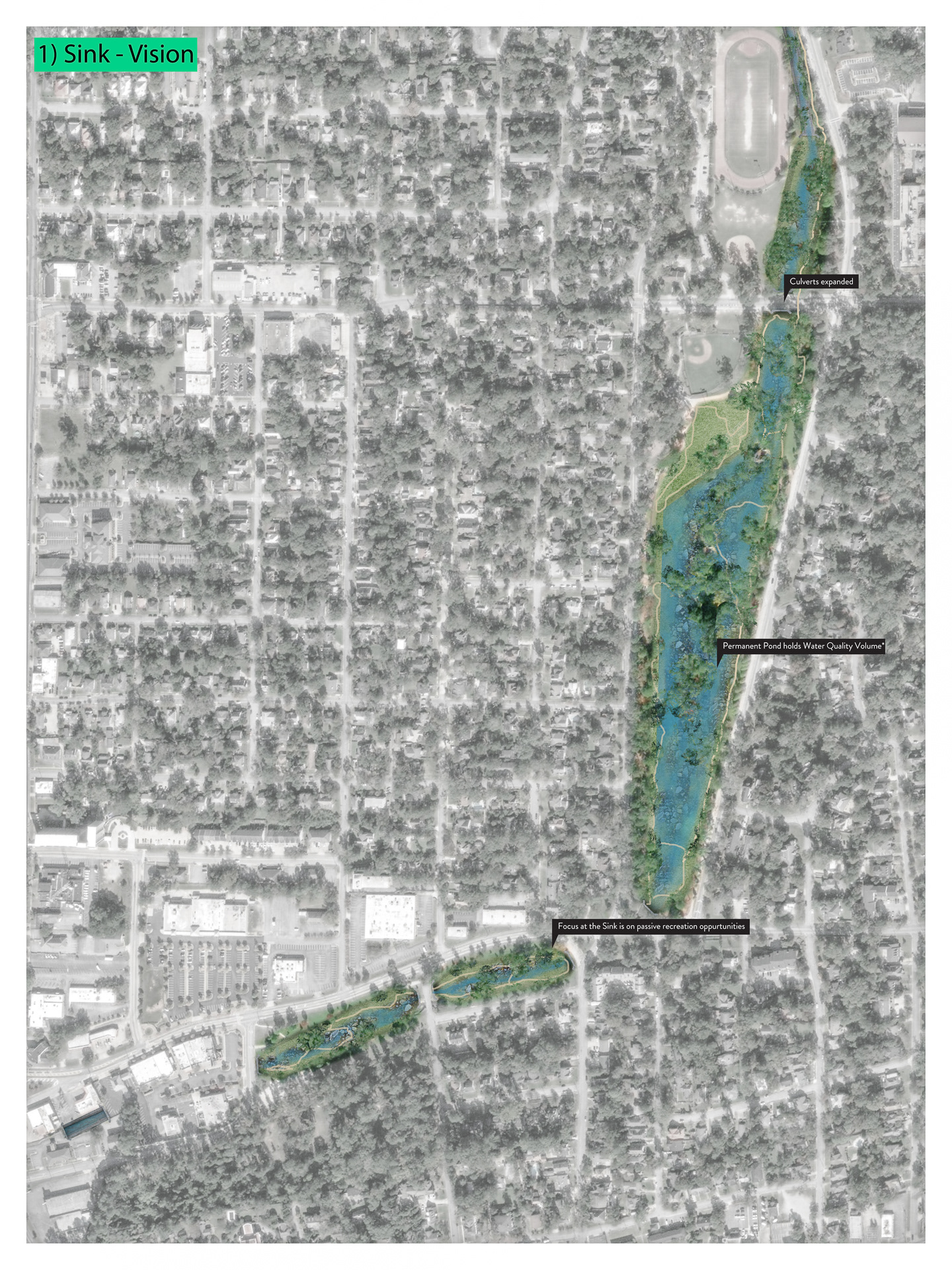
1) Sink aims to add flood storage at the large acre parks in the wealthier upstream neighborhoods. Combined detention/retention basins provide both blue and green performance, passive recreation, wetland habitat and groundwater infiltration.
2) Pass aims to pass the 500 year storm event and prevent flood downtown. Land banking will allow Columbus to combine and redevelop existing land uses into a vibrant water-focused commercial space. Daylighting the stream with the proper stormwater conveyances allows increased density in the areas downtown which currently flood.
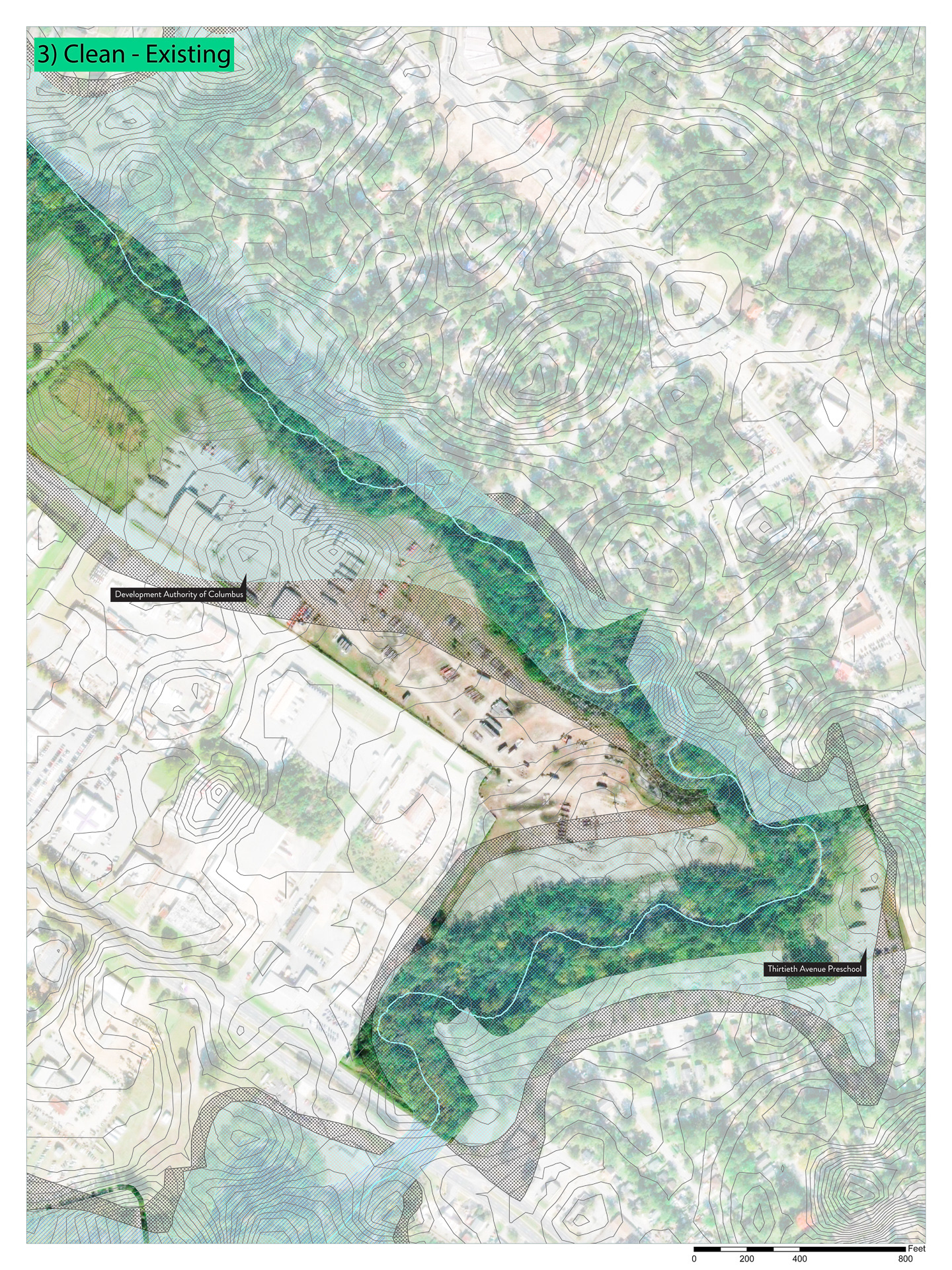
3) Clean aims to improve the stream quality as it leaves the Weracoba watershed, improving upstream-downstream relations. Strategies which improve stream quality include water quality monitoring stations operated by local school children, trash catch basins and riparian vegetation planting. New public access to the water will change the industrial land uses to denser commercial over time, forming stronger connection between these neighborhoods to Chattahoochee River and downtown.
Calculating Stormwater Conveyance