Collaborators: Farmer | Morgan LLC, PM Environmental, Jessica Nielsen
Project Description
The Brownfields Area-Wide Planning (AWP) Grant was established by the Environmental Protection Agency (EPA) to provide funding and technical assistance to communities that want to remediate and reuse potentially contaminated properties. Abandoned contaminated lots are prevalent in the urban fabric of any city, big or small, and these lots often affect property rates and real estate development. However, once cleaned they hold the potential to revitalize neighborhoods and stimulate the local economy.
Middlesboro, located in Bell County, Kentucky was a thriving city of the 20th century that has slowly declined. Consequentially, many businesses, industries, and factories have abandoned their properties and structures. PM Environmental saw these vacant properties as an opportunity to repurpose available infrastructure, stimulate the local tax base and create a better and healthier living environment. Farmer|Morgan, LLC was hired as planning and design consultants to assess and visualize redevelopment potential of these properties within the Trace District study area for Middlesboro.
A series of community design workshop meetings were held from February 5-9, 2018 in the Middlesboro School’s Central Arts Building to analyze redevelopment potential for the City of Middleboro. The design workshops were an opportunity for residents and stakeholders to participate and visualize redevelopment scenarios of these brownfield sites. The plan investigates opportunities for reimagining ways the city can capitalize on the history and natural beauty of the mountains that surround it. Middlesboro sits at the foot of the Cumberland Gap, known as the “Gateway to the West,” and the plan explores cultural, and recreational opportunities that can help the city capitalize on this prime location.
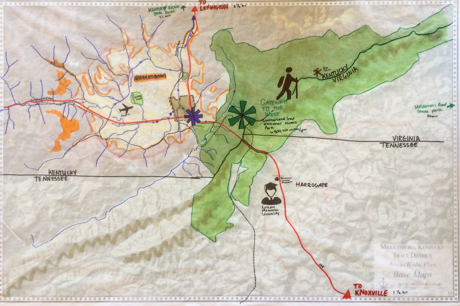
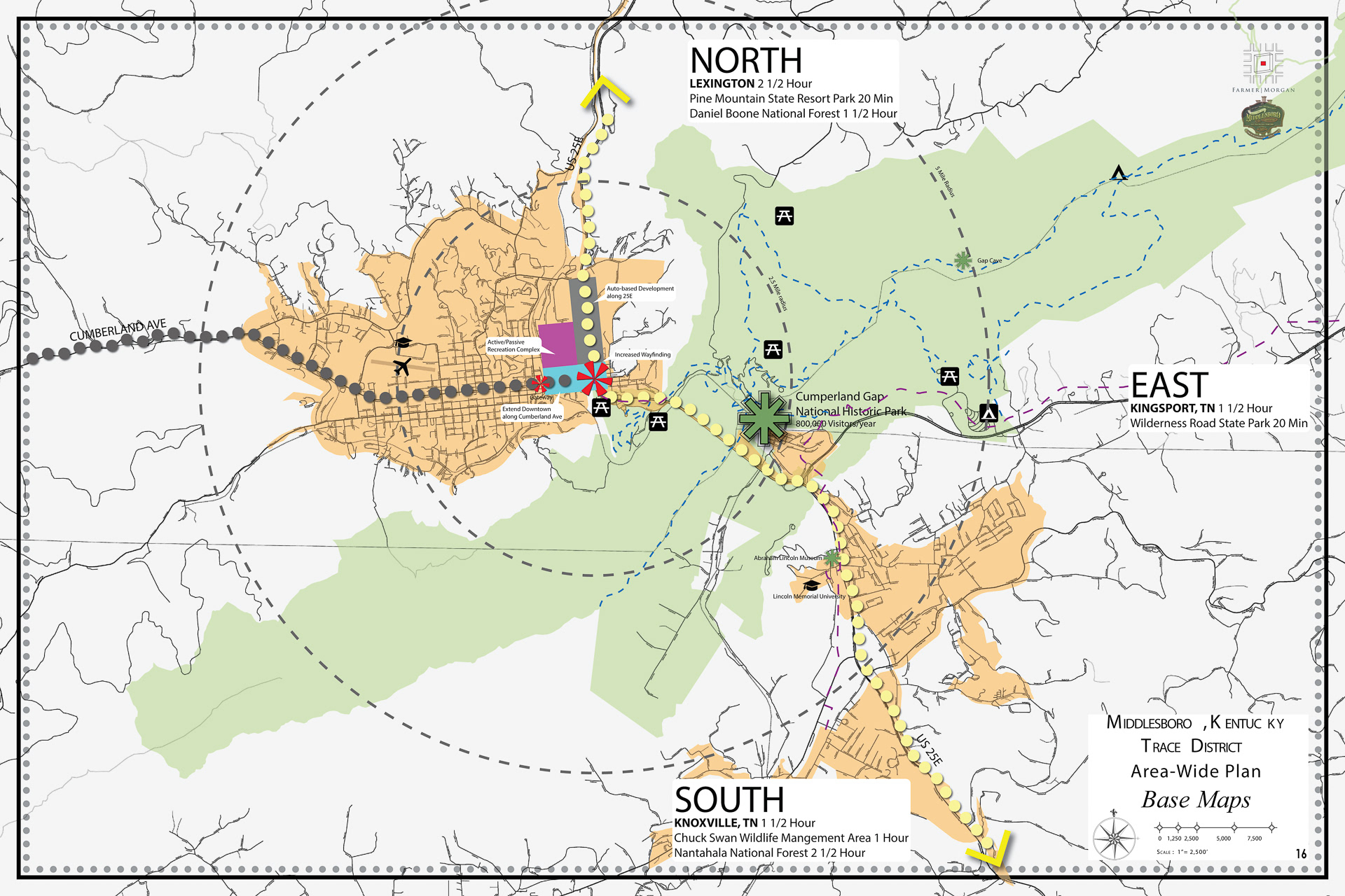
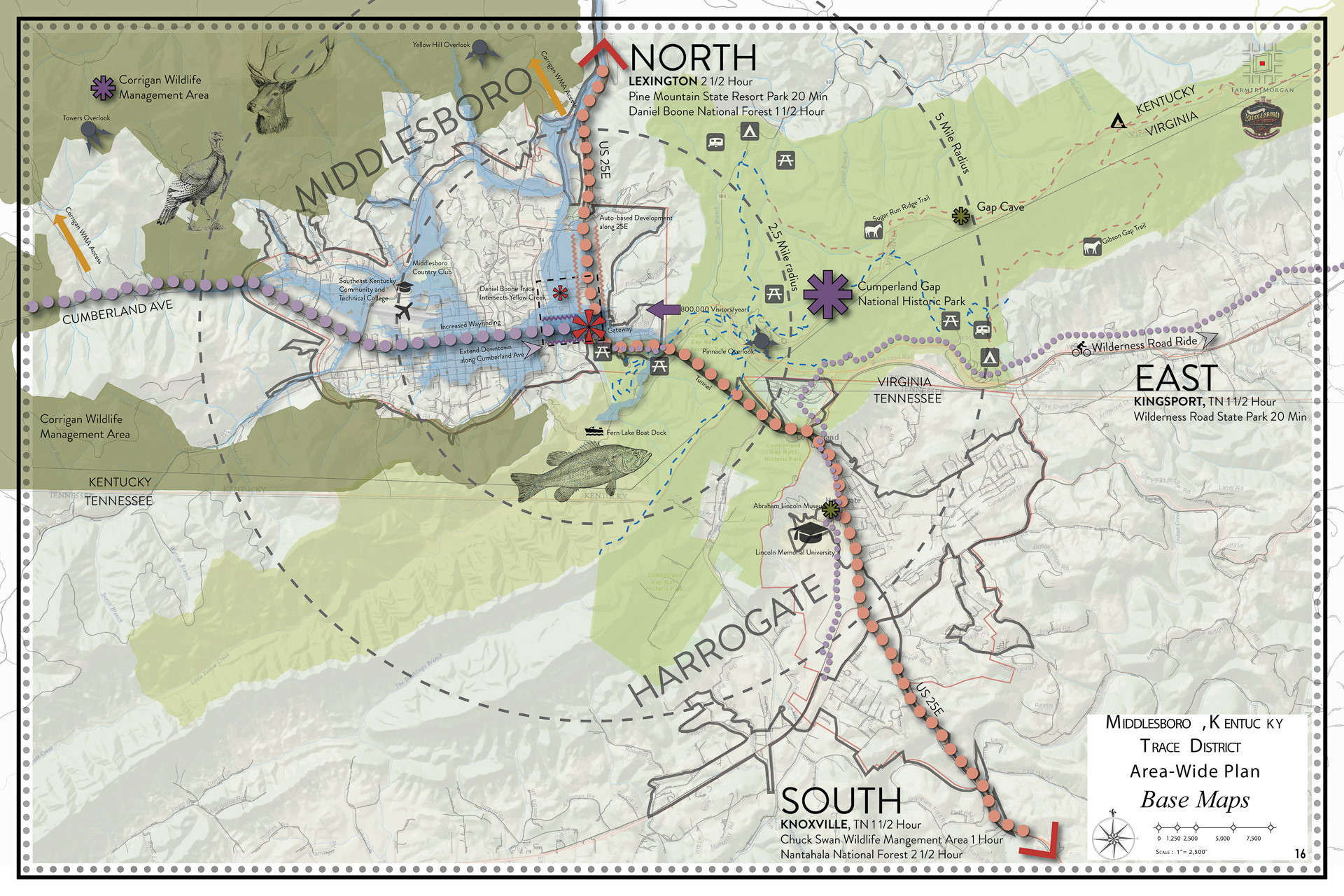
Regional Context
The cultural, economic, topographic and ecological context of the site was used to help inform goals for the project site. The Cumberland Gap National park receives 820,000 visitors each year, giving an opportunity to capitalize on tourist expenditures, while the surrounding hills and peaks strictly contain the developable area for Middlesboro proper. The bowl shaped terrain leads to flood hazard.
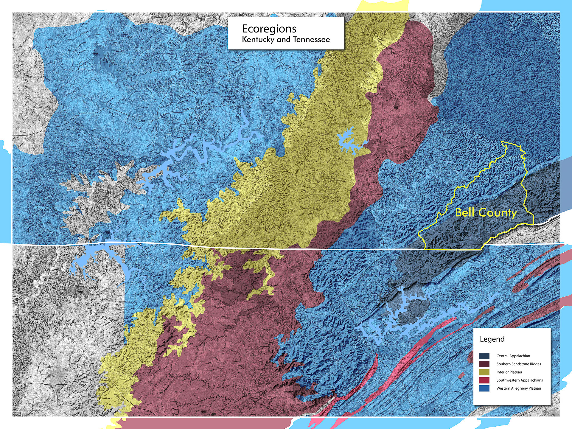
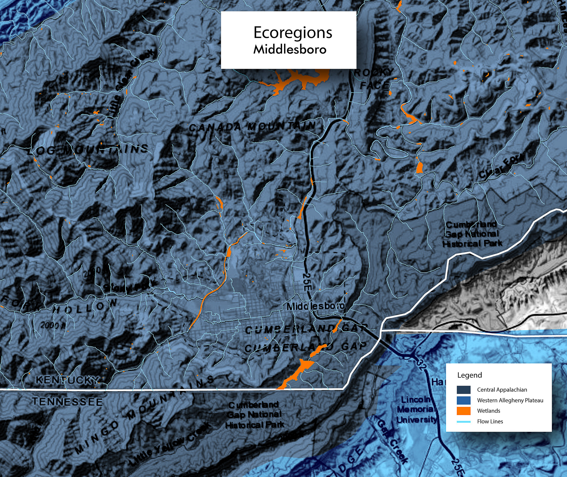
Ecoregions
Middlesboro’s terrain supports two ecoregions, the Central Appalachia and the Western Allegheny Plateau. The central Appalachian has a higher topography than Western Allegheny and correspondingly the climate is more severe with hot summers and cold winters. The forests in the region are mostly chestnut oak, red maple, white oak, black, oak beech, yellow-poplar, sugar maple, ash, basswood, buckeye, and hemlock. Animal species that have been prevalent at this topography include black bear, white tailed bear, red fox, gray fox, bobcat, weasel, red squirrel, big brown bat and wild turkey, darter, minnow, hermit thrush and sculpins. This ecoregion is known for its surface and underground bituminous coal. The Western Allegheny Plateau ecoregion found here was unglaciated during the first ice age and it has a form of a dissected plateau which has layers of sedimentary rock. The Kentucky warbler, northern water snake, dusky salamander, pileated woodpecker, and barred owl are some species that are found in this ecoregion distinctly.
Some other ecological regions of high diversity that are prevalent around Middlesboro are Southwestern Appalachia and Interior plateaus. With undulating and rolling tableland on the plateau surfaces to steep mountainsides with cliffs, Southwestern Appalachia has a rich variety of terrain and vegetation. The upland forests are known for their mixed oaks and shortleaf pine and include white oak, southern red oak and some hickories. Maple, buckeye, beech, ash, basswood, sweetgum, and oaks are some of the trees that are popular along deeper ravines. The fauna associated with this ecoregion include white tailed deer, black bear, bobcat, gray fox, raccoon, mink, gray squirrel, wild turkey, bobwhite, red eyed vireo, scarlet tanager and timber rattlesnake. Interior plateaus include a variety of topographical features which include rolling and irregular plains, karst plains, dissected plateaus, tablelands, open hills, and broad ridges. The vegetation includes blue eastern prairies, cedar glades, and mixed mesophytic forest and some of the common trees of this ecoregion are white oak, northern red oak, black oak, hickories, yellow poplar, red maple, and eastern red cedar.
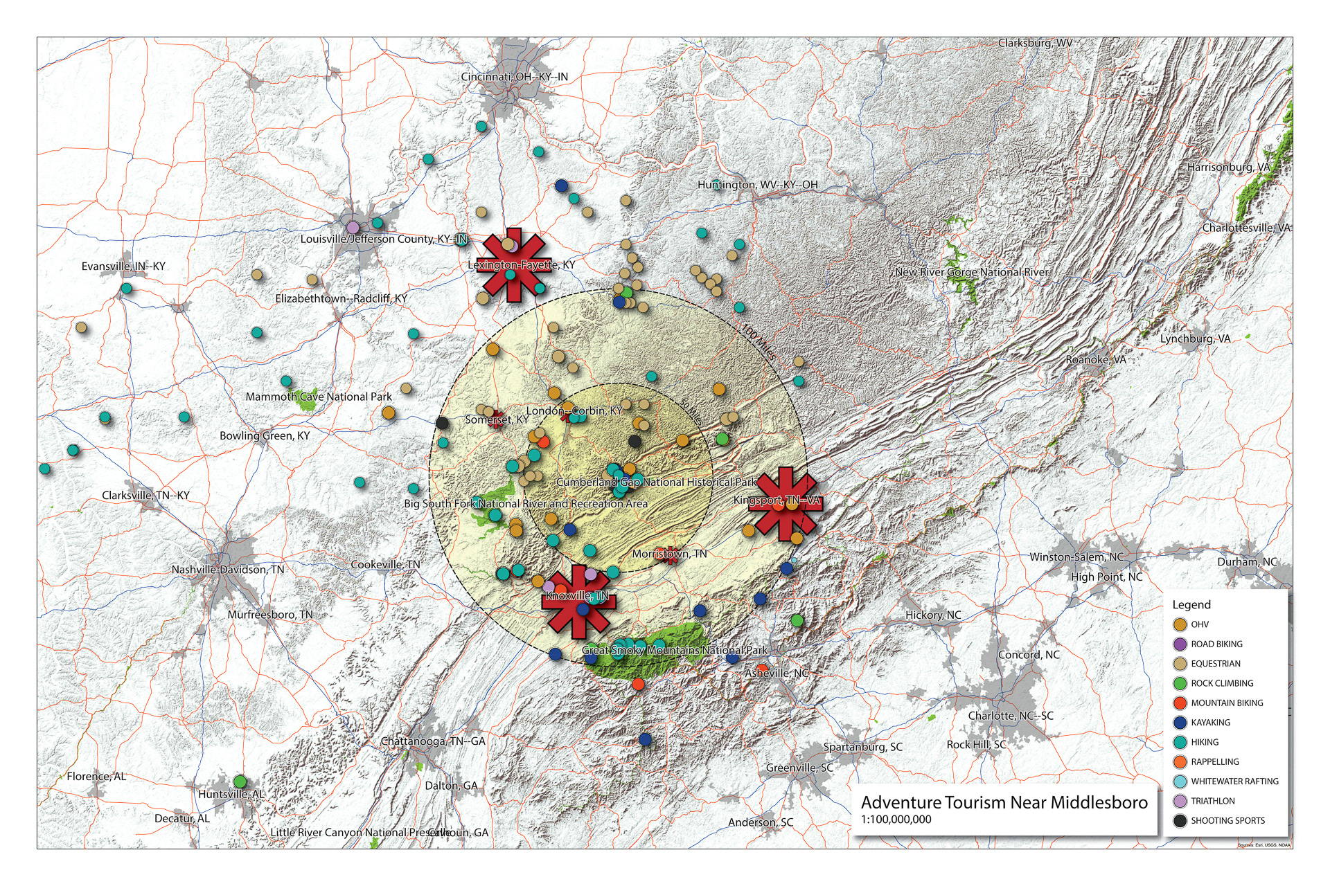
Opportunities and Competition for Tourism
The City of Middlesboro is presented a unique opportunity to increase tourism related activities and development due to its proximity to the Cumberland Gap National Historical Park and possesses great potential in its downtown city center. However, the city does not have effective physical connections within the town or to the surrounding areas and lacks supporting features, such as pedestrian and multi modal connections.
Using mymaps.google.com, I created a database of local and regional adventure tourism destinations. The following workflow created the final drawing: Google My Maps > Google Earth Pro > ArcMap > Illustrator
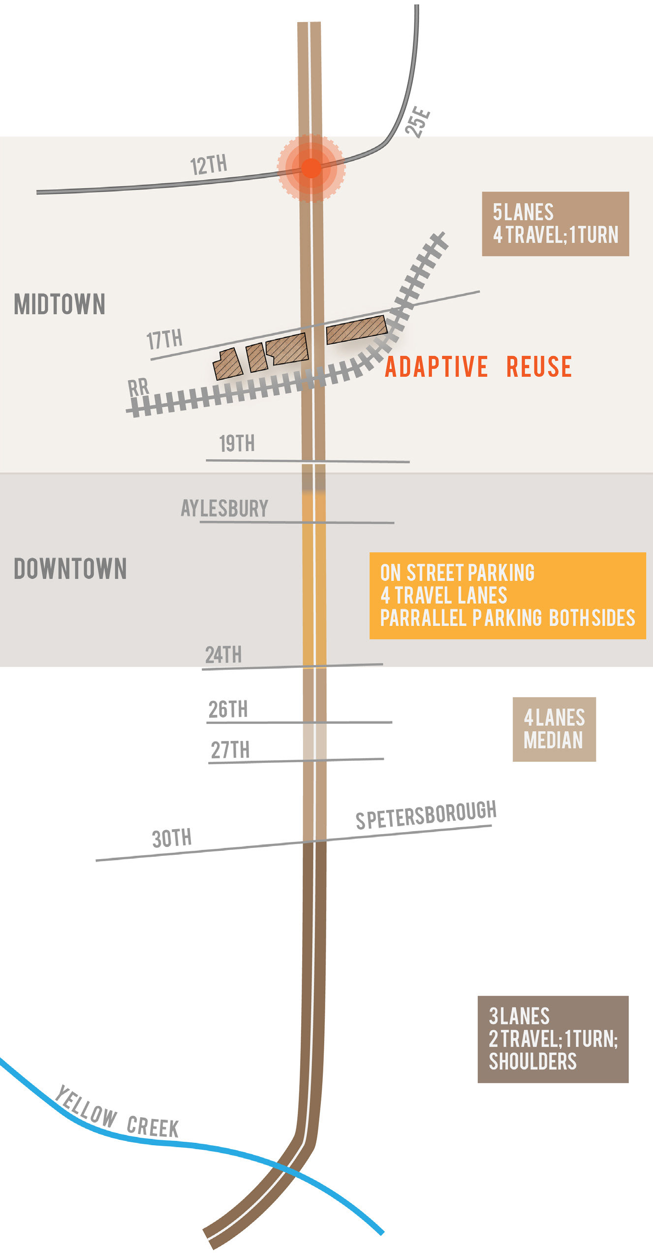
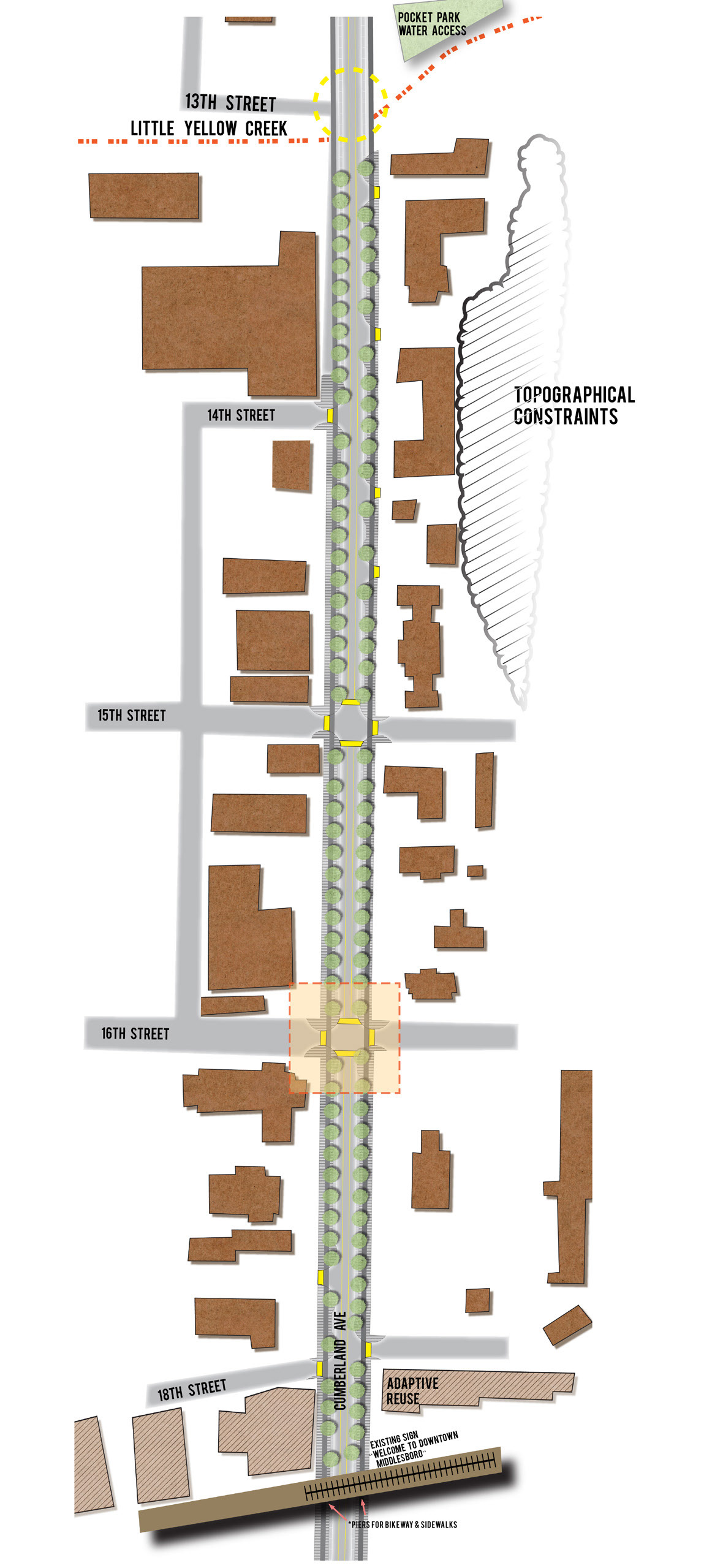
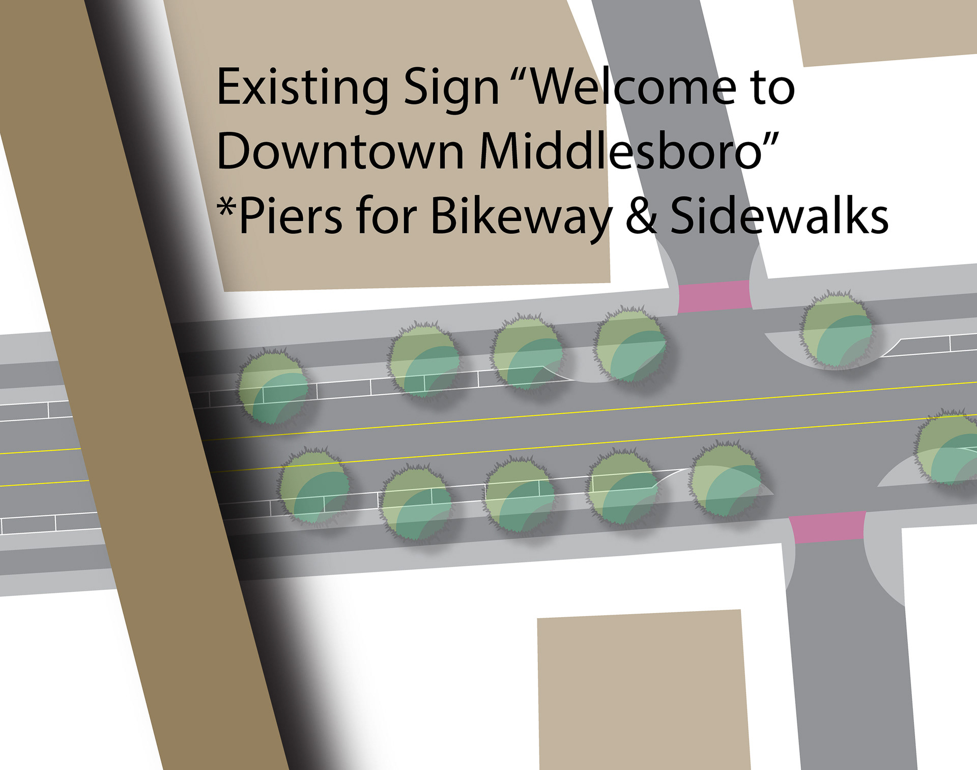
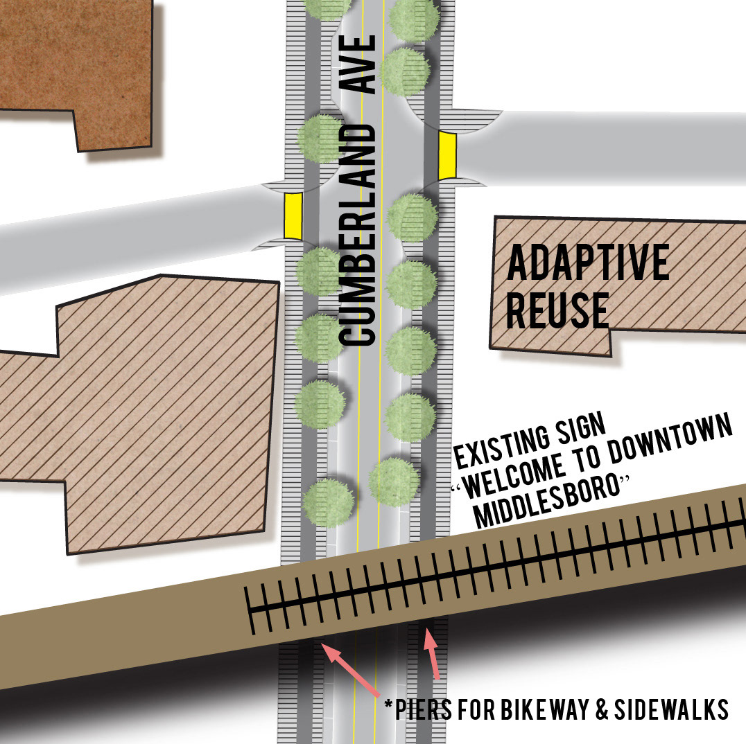
Road Typicals - Existing and Proposed
The lanes and road conditions along Cumberland Ave were recorded through site visit. This main route connects historic downtown Middlesboro with the project site. By decreasing lane widths and providing bike lanes with buffer zones and sidewalks, the proposed cross section will provide traffic calming measures without decreasing in capacity for automobiles.
View the final Report, produced by Farmer Morgan below.